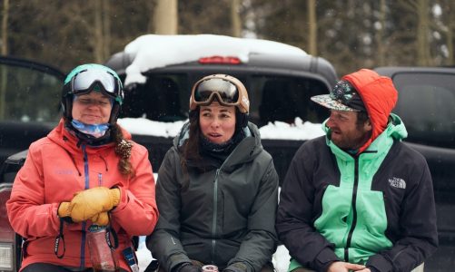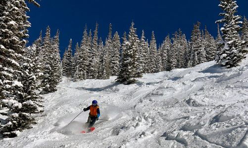
We talk a lot about skiing apps.
But then winter closes, and we disappear into the high country to camp, hike, boat, bike, and seek general adventure. So, we figured we could share some of our top picks for summer apps. While no download is perfect, these are the ones that guide our warm-weather escapades.
OpenSnow
What it’s for: Weather forecasts
Highlights: Hourly forecasts for precise locations (and elevations) // Forecasts for precipitation, lightning, temp, air quality, radar, wind—even wildfire smoke.
Why we use it: That’s right, your favorite forecast tool during the winter is just as good in the summer. Just like ski resorts and backcountry ski zones, you can use towns, high peaks, or even choose a custom location for fully customized forecasts. A couple of our favorite features that are pretty unique are the lightning and air quality forecasts. The mountains here in Colorado are rife with afternoon thunderstorms, so it becomes extremely handy if you want to know if “afternoon thunderstorms” means more like 5 pm, or more like right after noon.
AllTrails
What it’s for: Hiking, Trail Running, Biking
Highlights: GPS navigation // Route inspiration // Detailed route breakdowns and data // Trip tracking and recording // Community
Why we use it: Given how universal walking is, AllTrails has become a nearly ubiquitous resource for people seeking foot-based adventures. Its reservoir of routes and trip/hike ideas runs deep. And with 50 million users, you can count on finding other people’s opinions about the trail you’re considering. Whether or not you should believe them is part of the fun.
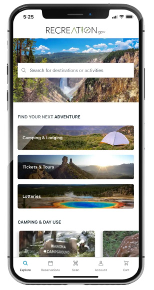
Recreation.gov
What it’s for: Camping and Adventure Reservations
Highlights: Permit lotteries // Camping reservations // Red tape (permits, tickets, etc) // Campground details
Why we use it: For people who seek primo adventures—specifically, the ones that require permits or reservations—Recreation.gov is essential. Use it to enter lotteries for high-demand activities or make reservations at high-demand or limited-access campgrounds, huts, and more.
Also check out: Reserve America
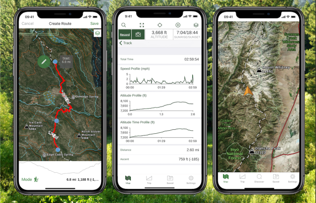
Gaia GPS
What it’s for: Navigation and Route Planning/Tracking
Highlights: Extensive map overlays // Saved routes // Route data and tracking // Weather and terrain features
Why we use it: There’s a reason a slew of adventure companies offer backcountry navigation classes with Gaia as the centerpiece. It’s a high-powered download with a long list of features and integrations. From satellite overlays and slope angle shading to public land maps and precise route tracking and archiving, Gaia’s applications reach far. A few of us use Gaia throughout the winter for backcountry ski route planning, so it becomes our primary mapping software in the off season too. But beware, this app is a part of the Outside network with a notable use fee. That does give you access to Outside TV and Trailforks, which handy as a mountain biker.
Also check out: OnX Backcountry
Campendium
What it’s for: Camping
Highlights: Dispersed camping // National + State parks and forests // RV and tent campground info // Free + paid camping
Why we use it: If you’re rolling into a new area and need somewhere to sleep, you want to be able to find possibilities easily and quickly. Campendium serves up deep options, including paid and free sleep sites. The app also provides the latest news on policies, regulations, logistics and all the other boring (but essential) pieces of the trip planning puzzle.
Also check out: FreeCampsites, The Dyrt
Ride with GPS
What it’s for: Cycling
Highlights: Desktop and mobile app mapping // Route finding + planning // Water + Bathroom + Trailhead POIs
Why we use it: If adventuring on your bike—dirt or pavement—is how you like to spend your summer, this is a great mapping tool. You can utilize their open-source heatmaps and routes other cyclists have put together for inspiration. Or, use the route planning tool. This app is free with paid add-ons, but a vast majority of the features can be done with the free version.
American Whitewater
What it’s for: River Information
Highlights: Real-time river flow data // Route data and descriptions // Put-in and Take-out details
Why we use it: Whether you’re looking for a chill stretch of flat water to stand up paddleboard with your dog or some rowdy Class IV kayaking, American Whitewater offers a deep library of river information. An interactive map allows you to pick a section of river suitable to your abilities, and real-time stream flow data helps you know what to expect when you get there.

Geocaching
What it’s for: The world’s largest treasure hunt.
Highlights: Local data and maps // Geocache types and accessibility
Why we use it: Looking for a rainy-day activity, or one for the whole family? Geocaching is a real-life treasure hunt—and if you aren’t familiar with it, you’ll be shocked at how many geocaches could be hidden near you at this very moment. Grab a bike or set out on foot, and link up several caches in a morning.
Kayak
What it’s for: Travel
Highlights: Fare aggregation // Flights metasearch // Explore tool // Hotels and rental cars // Price tracking
Why we use it: Plenty of fare aggregator and metasearch tools exist on the internet. Kayak remains one of the best. You’ll have a hard time beating the flight prices it finds, and the Explore tool allows you to search for destinations based on timing, price, etc. So when you find yourself needing to escape before back-to-school shopping hits, you’ll want to use Kayak to make it happen.